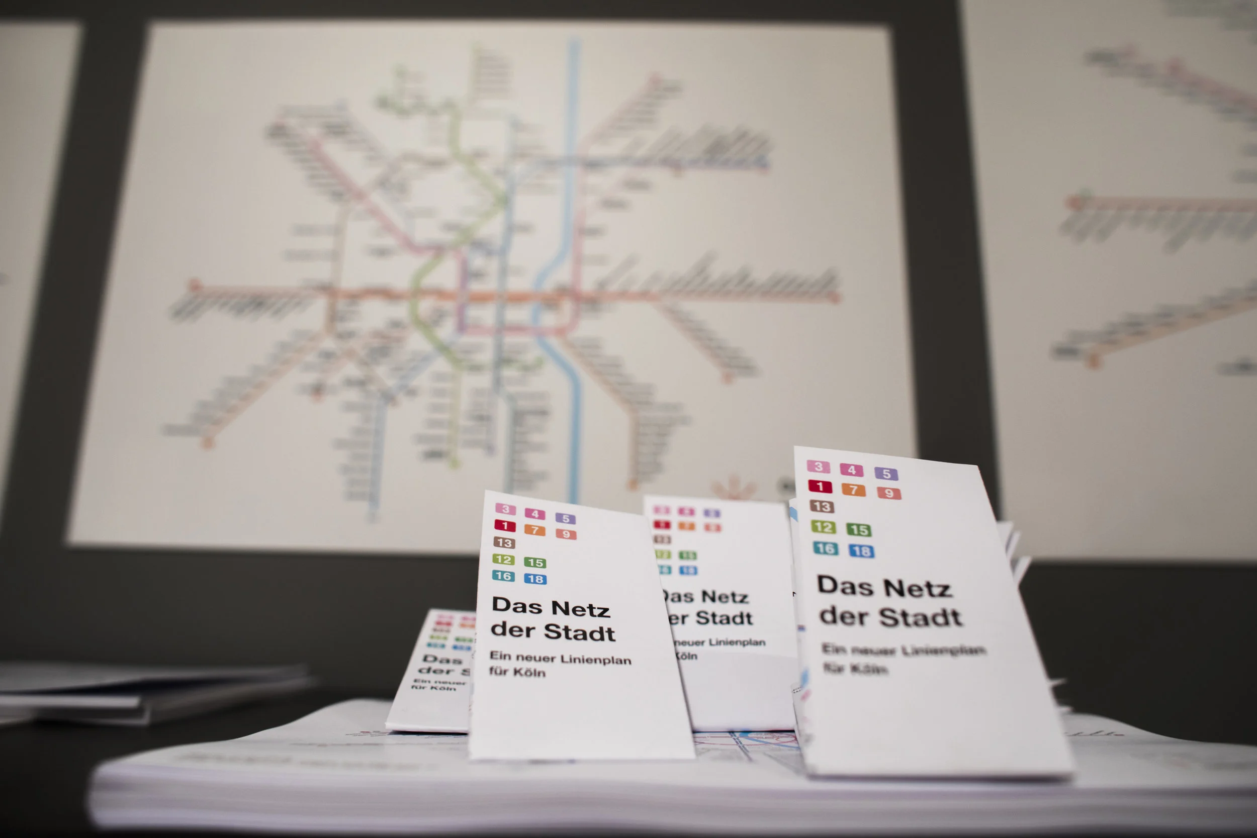


das Netz der Stadt - New information Design for the kvb
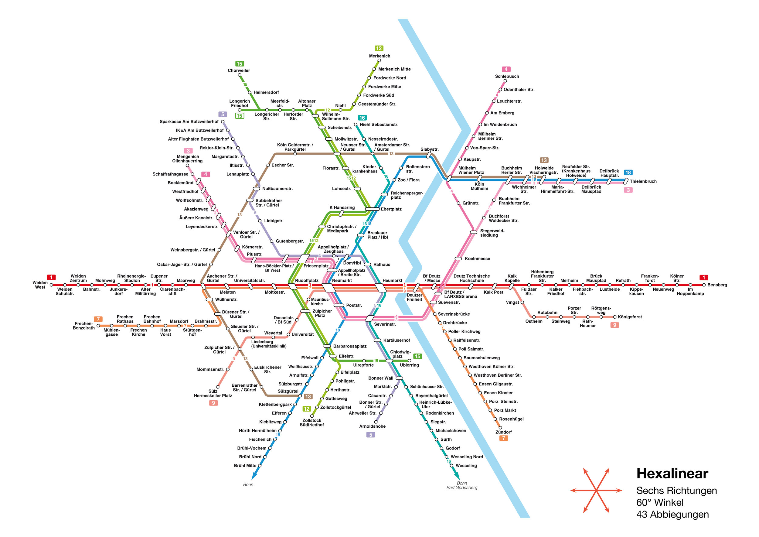
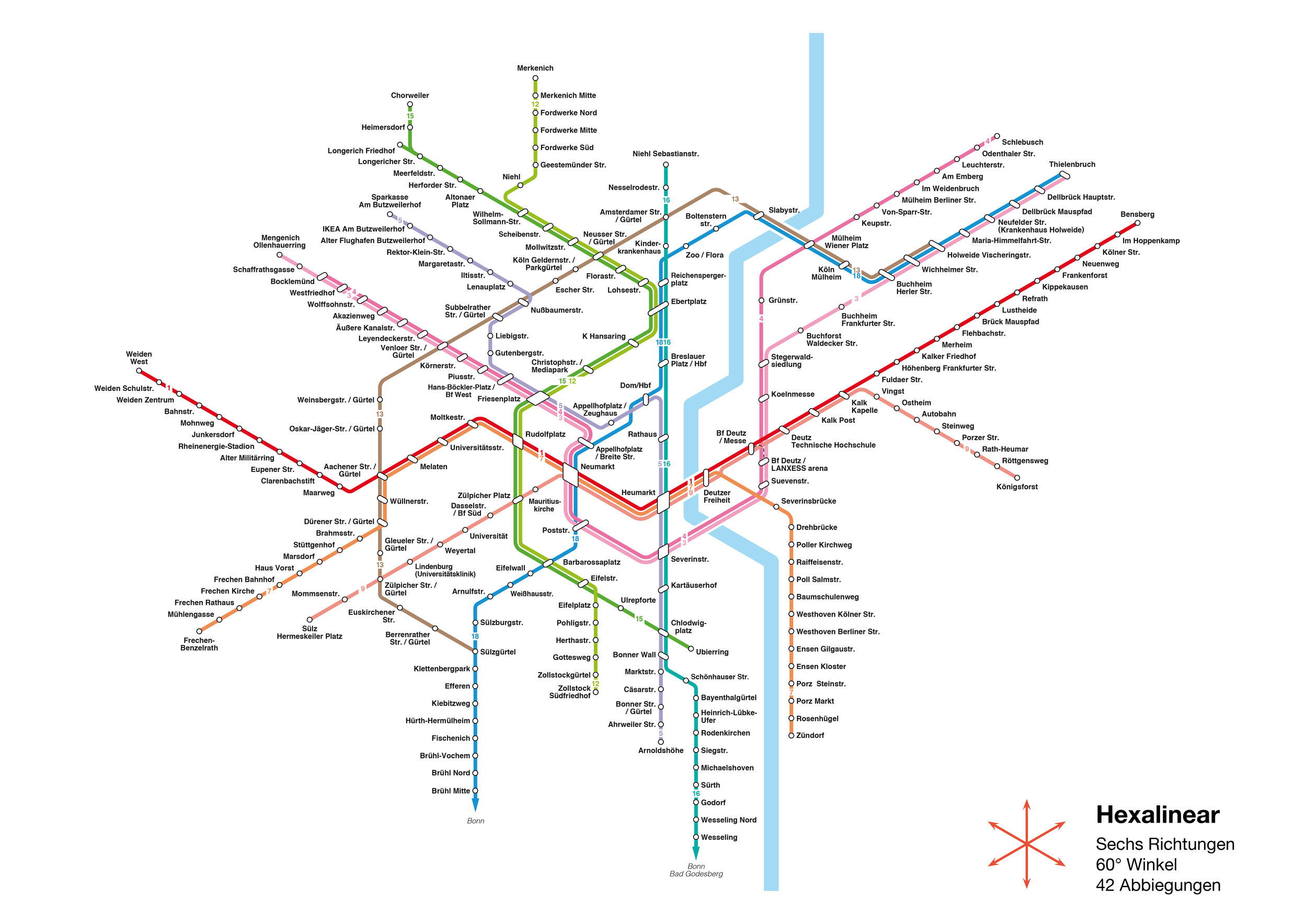
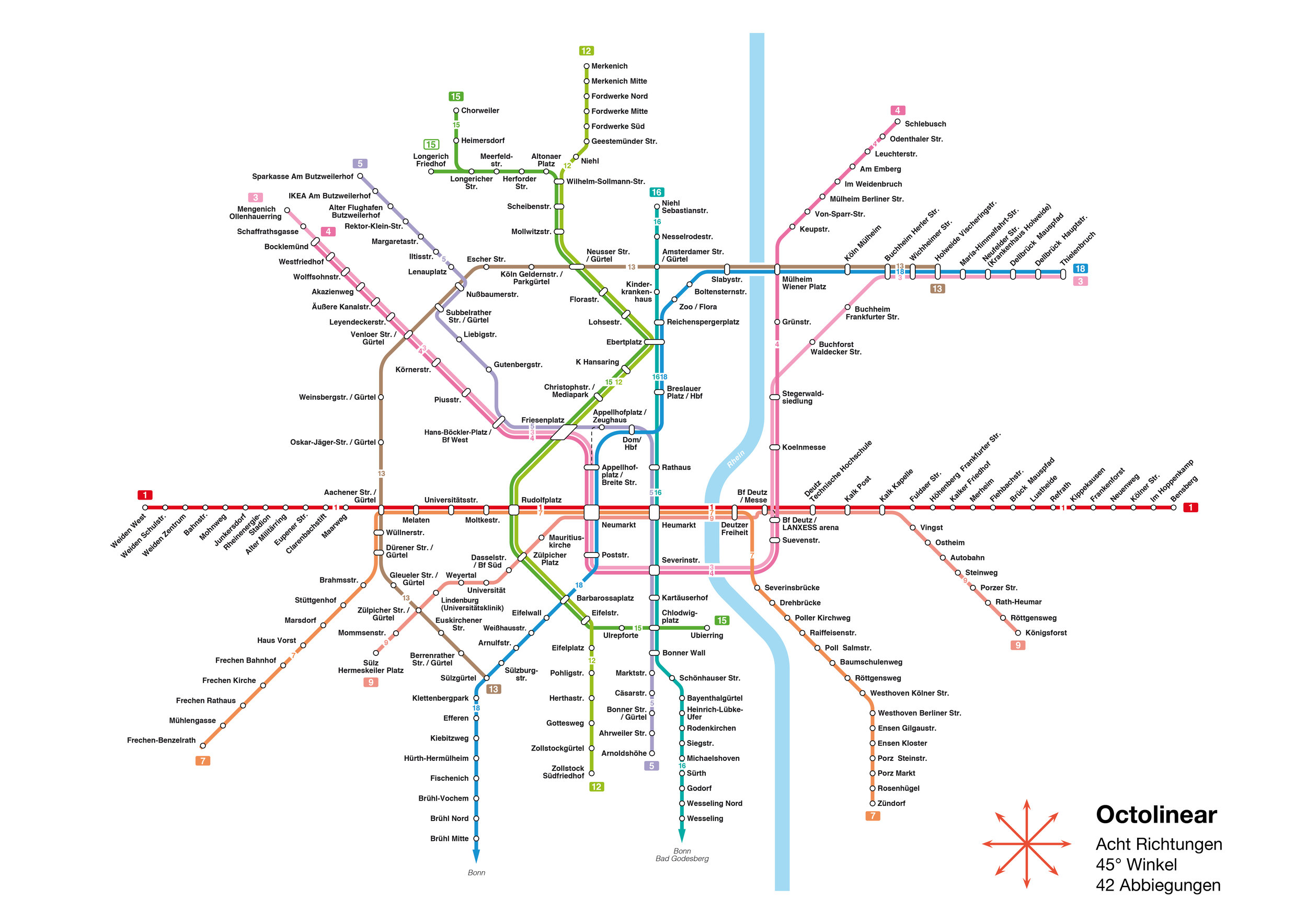
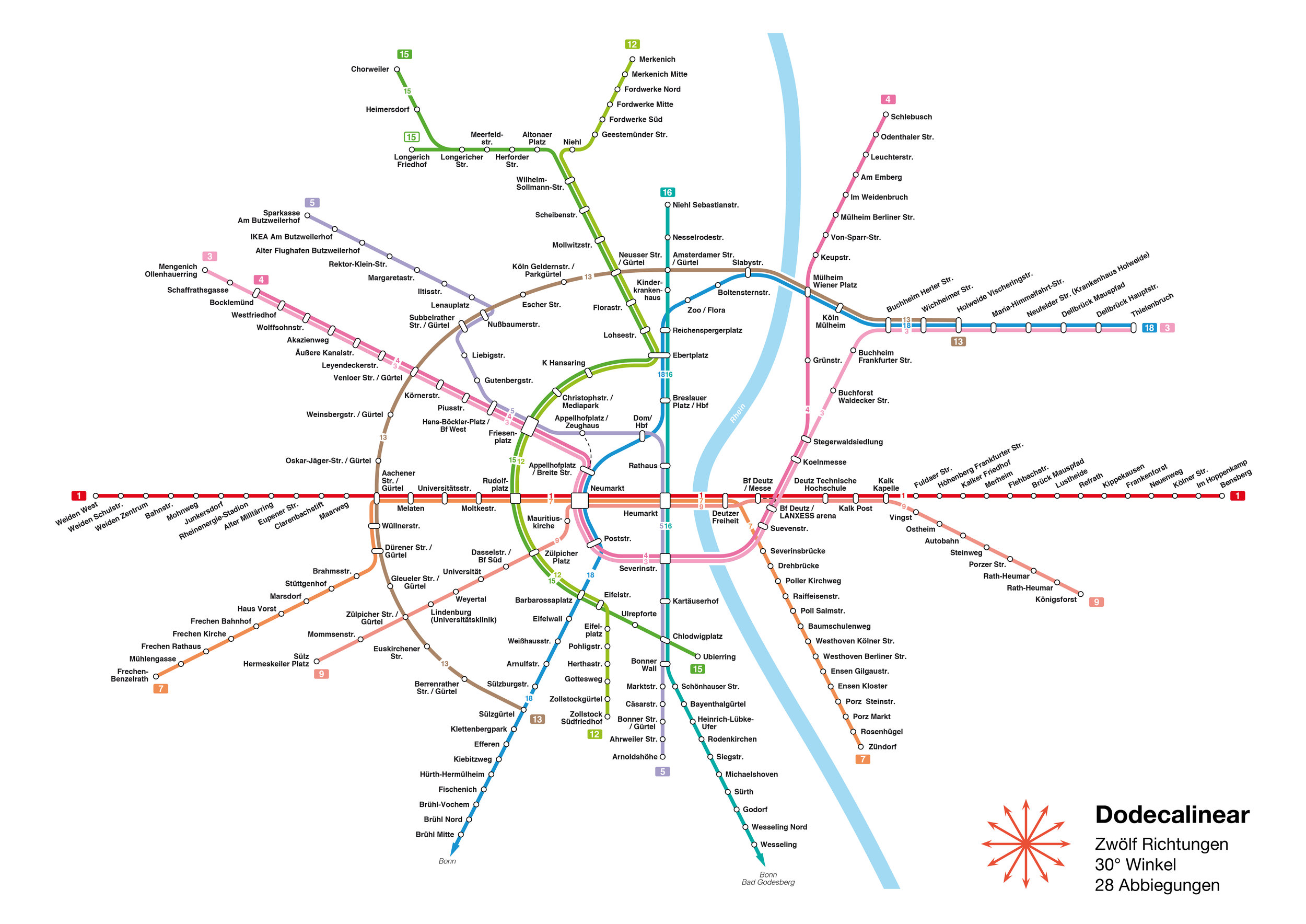
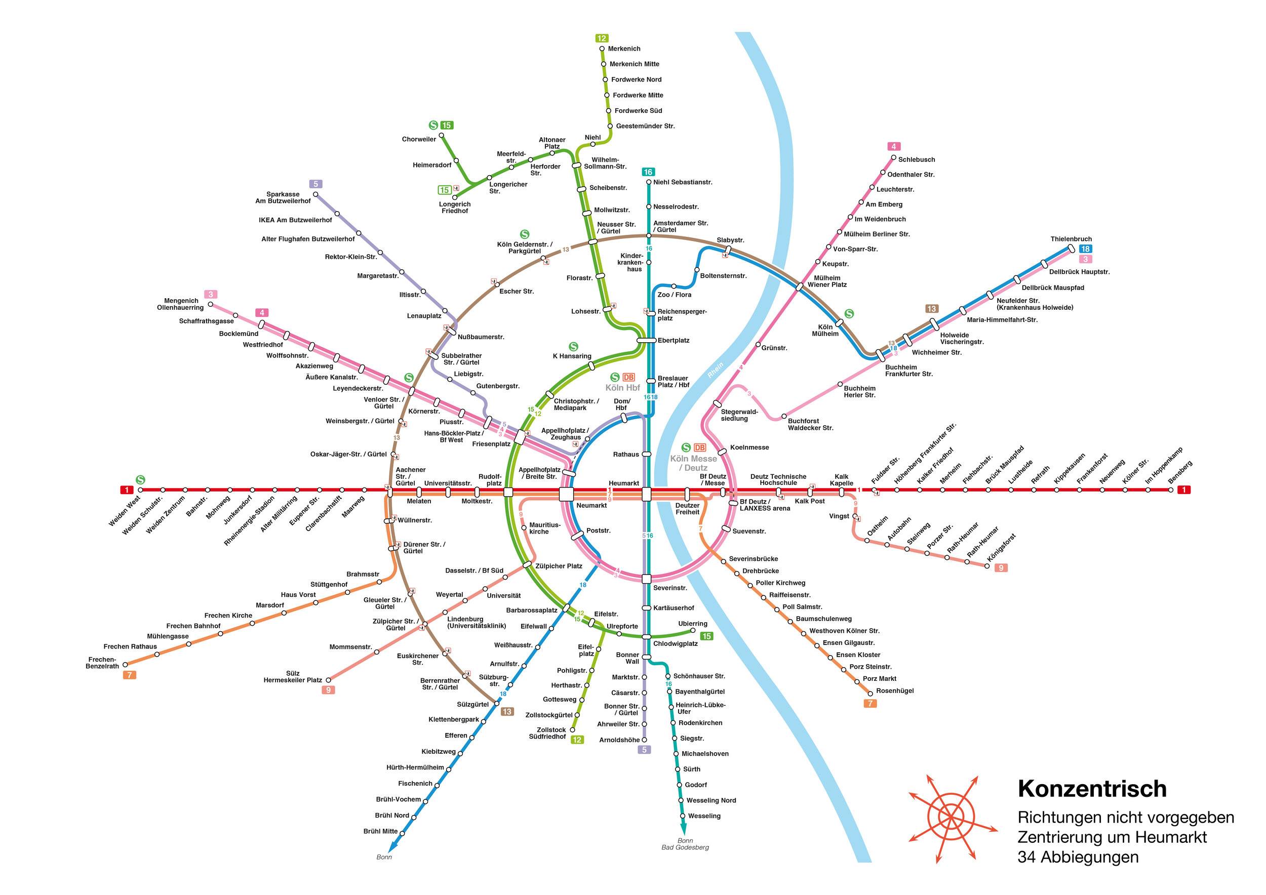
In order to make the structure of the city more understandable, the information design of the KVB was intervened with in two different places: First, the diagrammatic subway maps were revised, which are usually created according to the widespread 45 ° principle. In order to reduce information, the trajectories are therefore not geographically accurate, but rather simplified and diagrammed. This simplification is based on a grid that allows only eight possible directions. This may work well for cities like London or New York, but is suboptimal for the circular structure of Cologne. In this work, different rasters and construction methods were developed, which reduce the amount of information with every new map and manage to be geographically more accurate than the current maps of the KVB. The final plans (concentric and dodecalinear) reflect the image of Cologne much better and allow for a much faster route planning within the city.
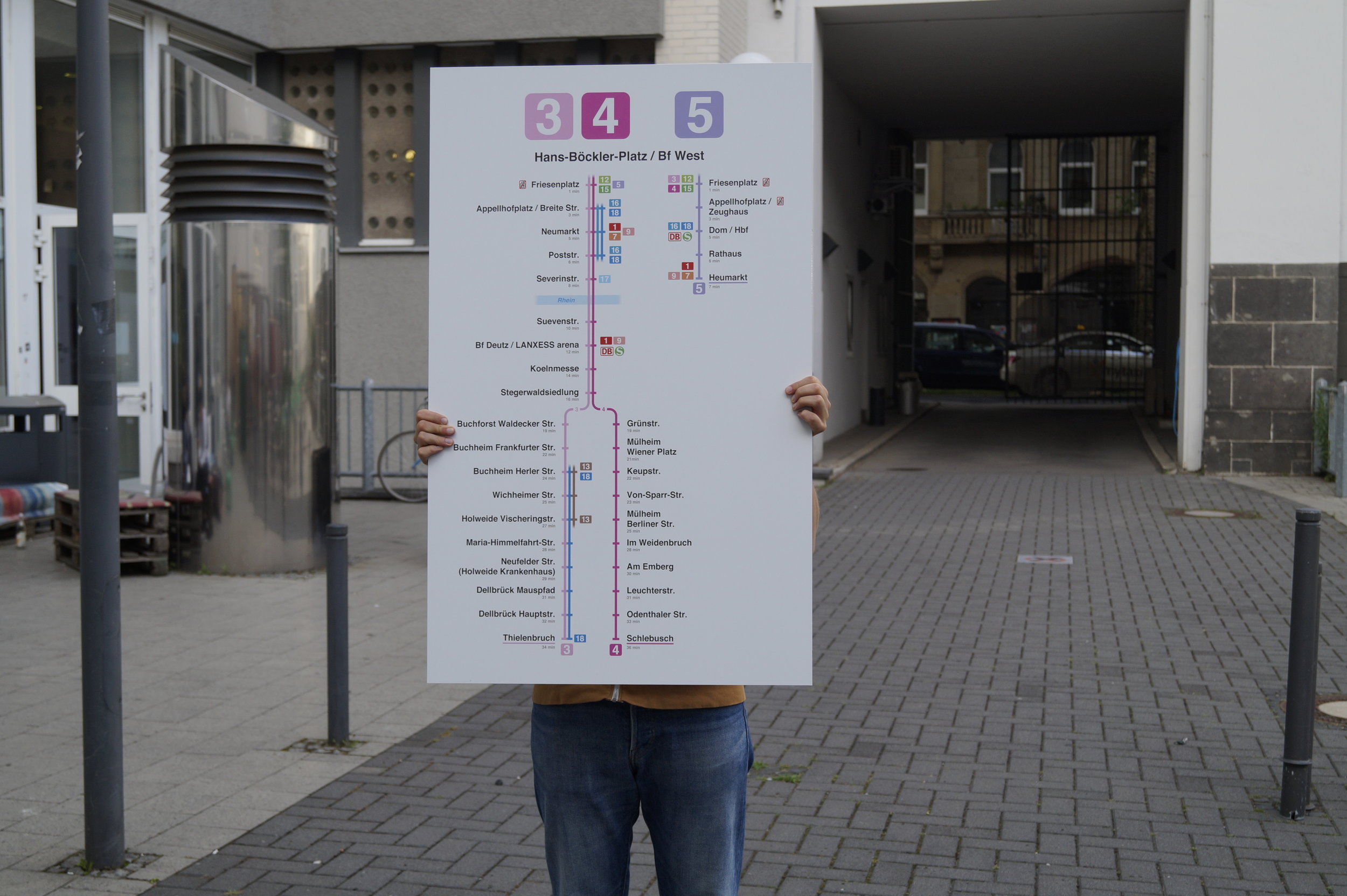
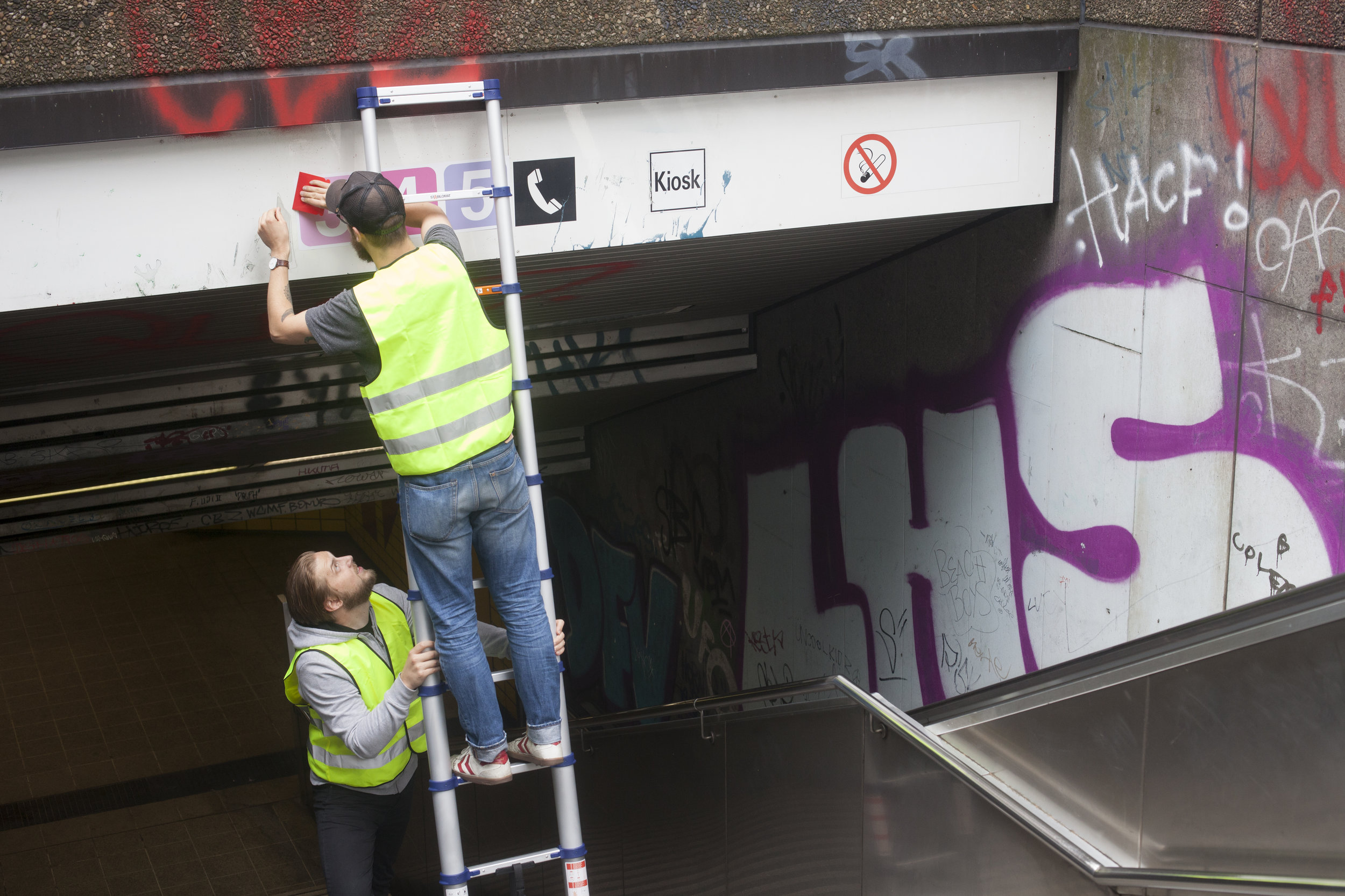
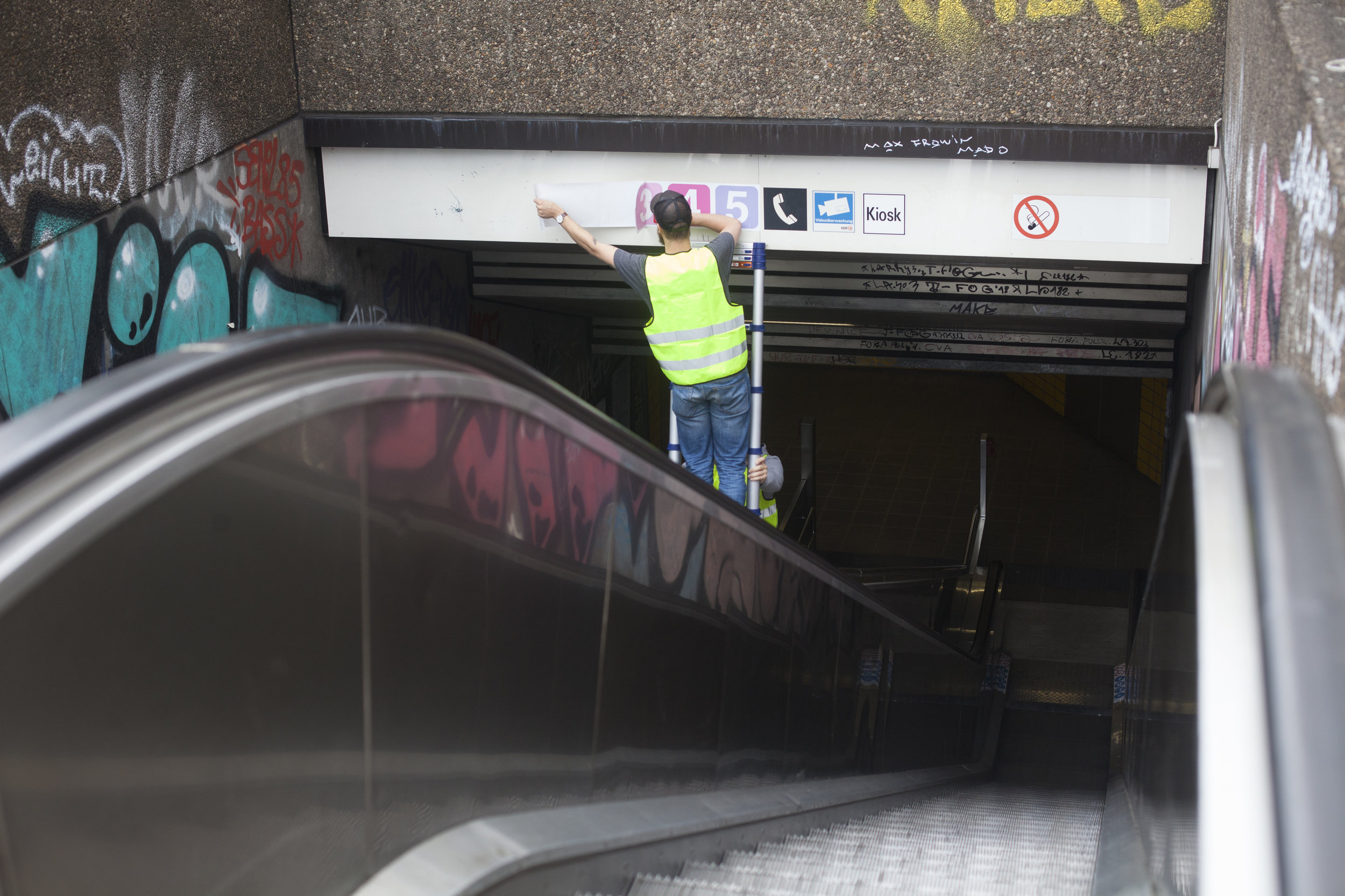
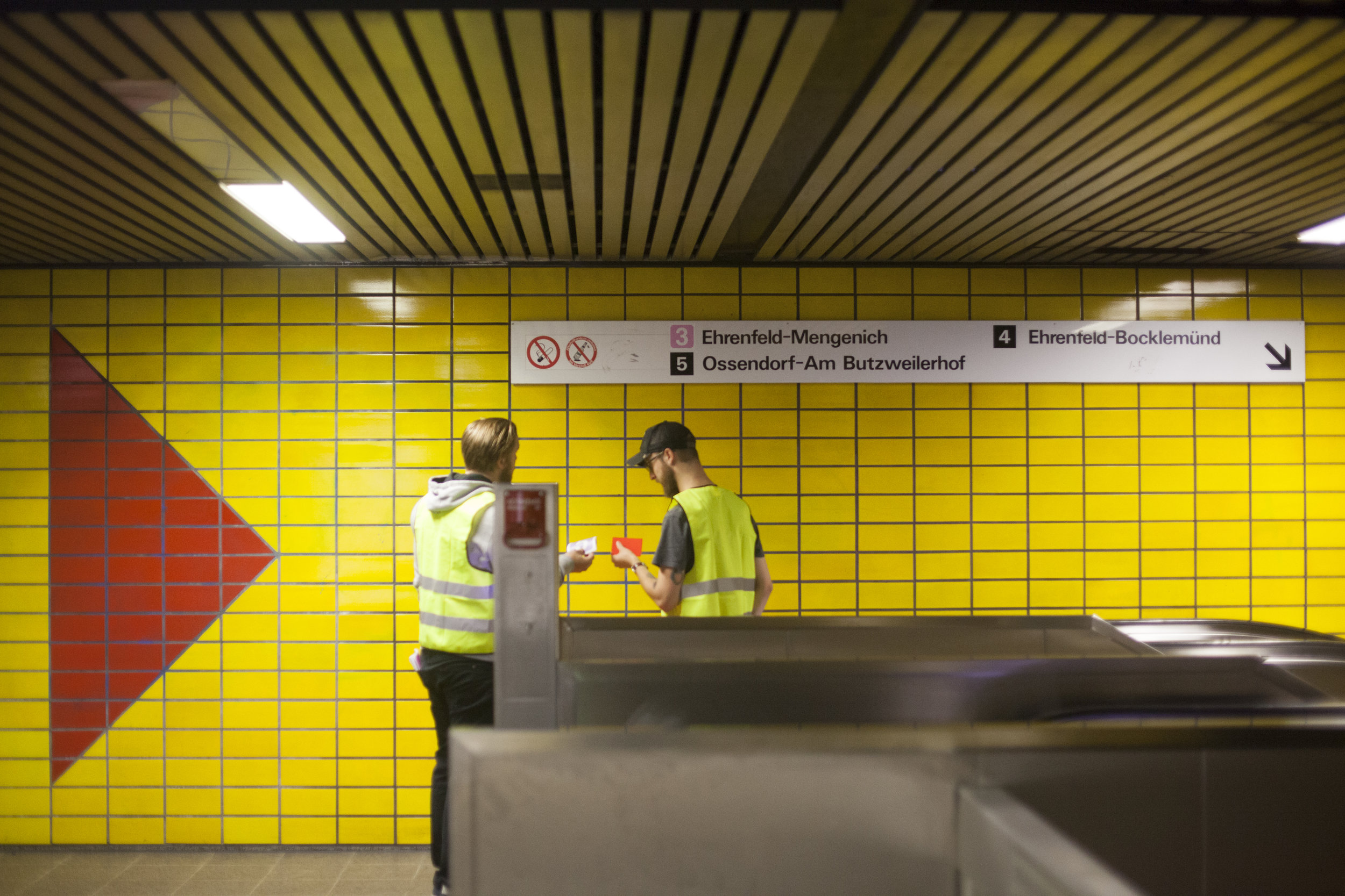
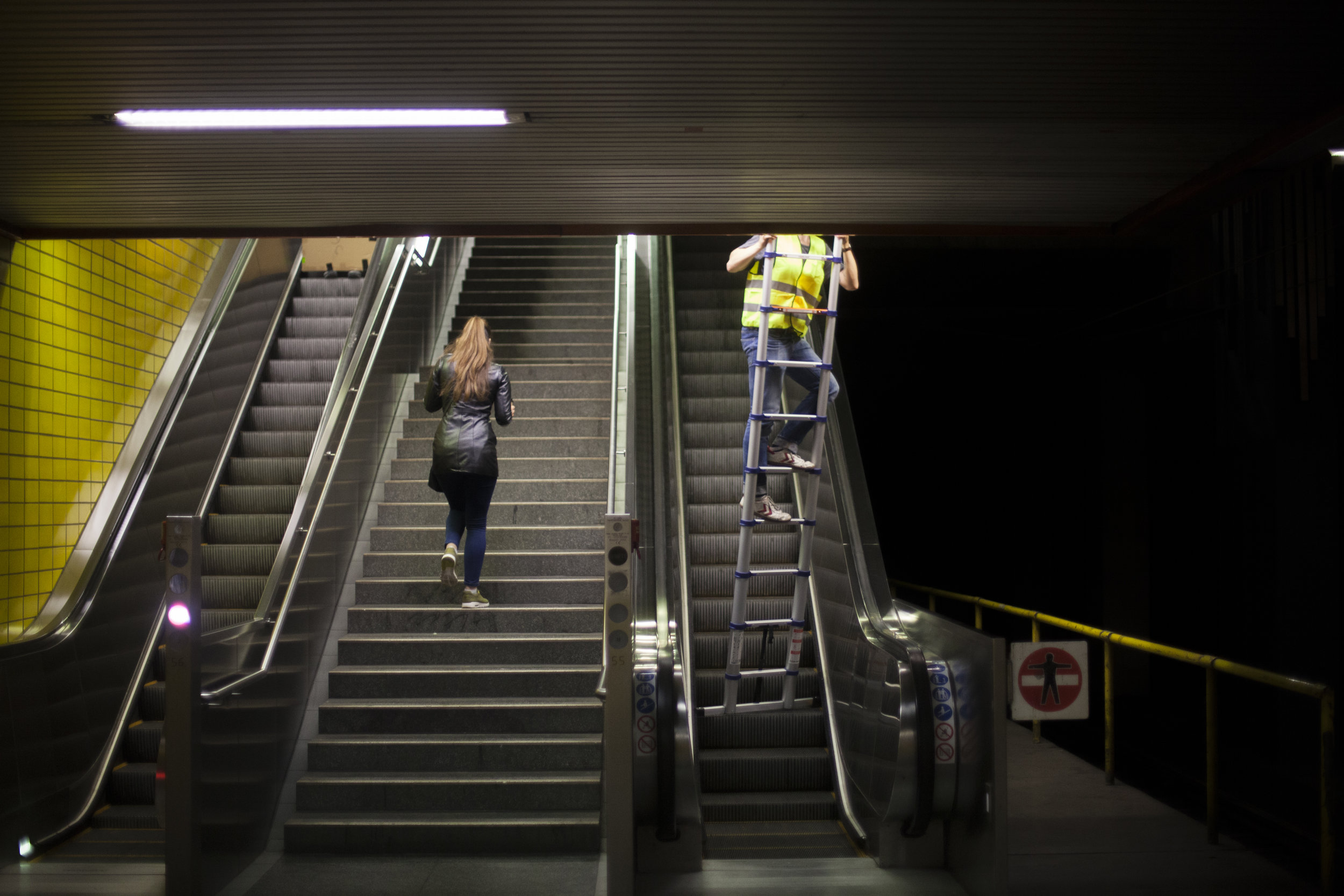
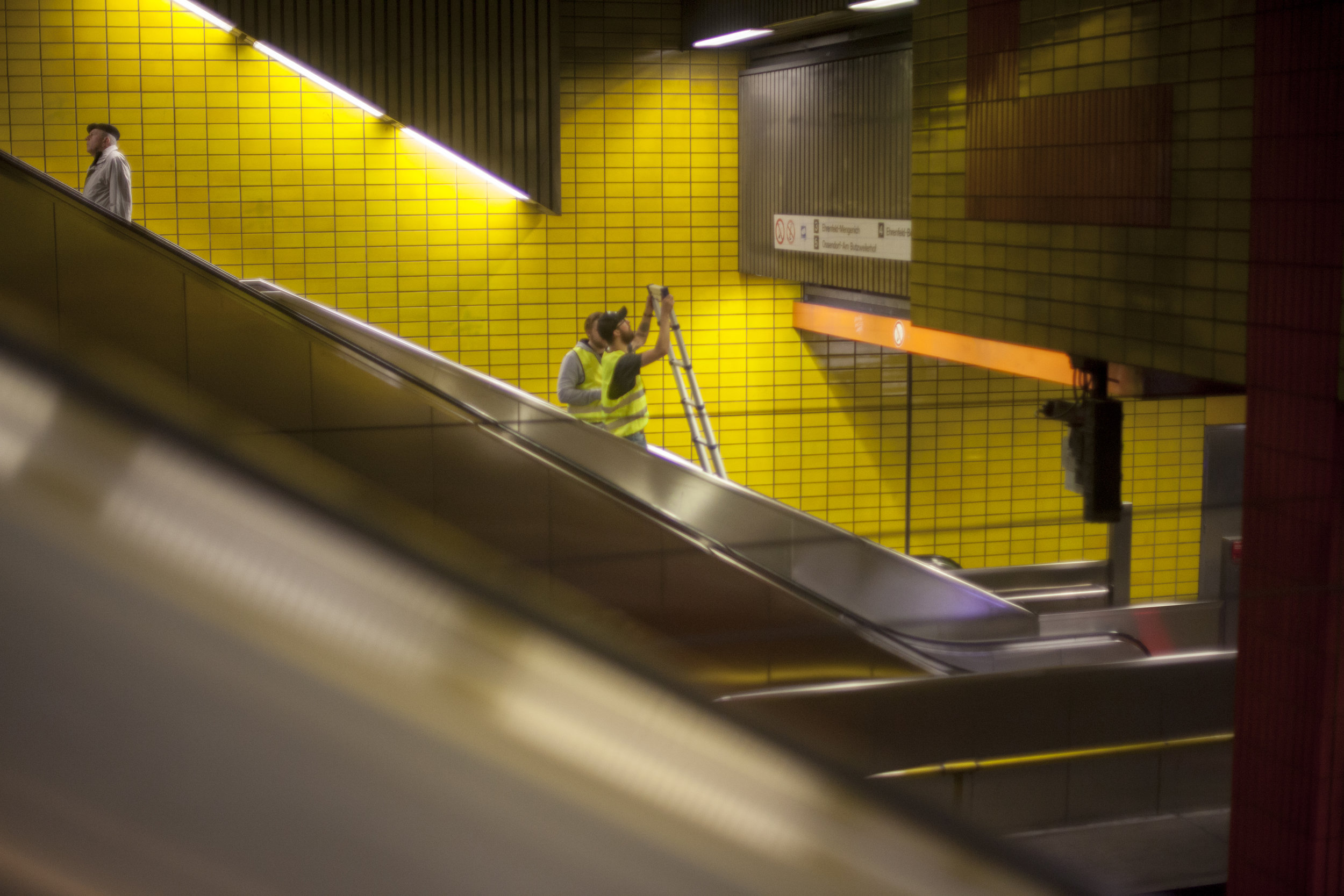
In addition, signage systems were developed for the individual stations, which should counteract and solve the problem that a large part of KVB customers get lost at stops or on their way. These new signs lists the stops that the trains approach, as well as transfer options and travel times, to give passengers a quick overview of their journey. As a pilot project, these signs were produced for the stop "Hans Böckler Platz / Bahnhof West" on aluminum dibond and placed at the station during a guerilla interference. They hung there for almost a month until the KVB finally had them removed.
Nominated for Kölner Design Preis 2018.